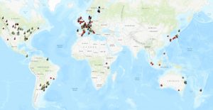
MAGGnet Interactive Map Updated
Experimental sites currently included in the MAGGnet network within the Croplands Research Group of the Global Research Alliance on Agricultural Greenhouse Gases (GRA), can now be viewed through an ArcView GIS webmap. Sites in the webmap can be viewed in aggregate or by crop type such as barley, rye, wheat and many other types.
MAGGnet, the Managing Agricultural Greenhouse Gas Network, was initiated as a multi-national research effort facilitated by the GRA. By employing a user-friendly spreadsheet template, MAGGnet seeks to compile metadata from experimental sites throughout the world where greenhouse gas fluxes and soil carbon dynamics are monitored. The overall goal of MAGGnet is to produce an inclusive, globally shared meta-database focused on the science of greenhouse gas mitigation.
Since 2012, MAGGnet has compiled metadata from over 380 experimental sites from 23 countries. Metadata contributors include scientists engaged in the Croplands Research Group and its networks, and the Paddy Rice Research Group of the GRA.
To read more about MAGGnet, including how to obtain access to the latest versions of the MAGGnet metadata entry template and sharing agreement, please click here.

